
Trace a Sanger Street by Address
An address-first Sanger street directory begins with the physical place, then moves through records that answer different questions. The assessor can anchor an APN and a January 1 owner snapshot. The Recorder can tie that parcel to a deed and an earlier grantor. Voter tools are narrower than many people expect, and older reverse directories describe listed occupants rather than every person at an address. Keep the chain in that order so a mailing address, owner, voter match, and directory entry do not get blended into one claim.
- Confirm the situs address and whether it falls inside incorporated Sanger or in the surrounding Fresno County service area.
- Use a permitted county map, roll, counter route, or data product to identify the APN and the owner or controller shown for January 1.
- Carry the APN, legal description, and owner name into the Fresno Recorder index. Find the acquisition deed, then search its grantor as an earlier grantee.
- Treat voter information as a limit, not a street list. My Voter Status checks one person's registration, while voter-file releases require an approved Elections Code purpose.
- Finish with the Heritage Center's Haines criss-cross material, which gives countywide address coverage from 1973, plus older directories and papers when the date fits.
That address-to-APN-to-owner-to-deed-to-voter-limit-to-Haines path is the practical street-by-street walkthrough. It separates ownership, recorded history, and listed occupancy before any comparison is made.
Sanger Street Records by Address
Address-keyed records in Sanger do not sit in one complete resident roll. Each custodian adds a separate layer, and the strongest street directory result comes from matching the same situs, APN, legal description, or date across those layers.
| Record Set | Keeper | What It Shows | Access |
|---|---|---|---|
| Assessment roll | Fresno County Assessor | January 1 owner or controller, tax-mail address, value, exemptions | Value lookup, counter, roll products |
| GIS parcel map | Fresno County GIS | Parcel shapes, APN and map context, jurisdiction and published layers | Free visual viewer |
| Deeds and liens | Fresno County Recorder | Recorded parties, instruments, legal descriptions, title events | Online index, office view, purchased copies |
| Voter data | California and Fresno elections offices | One-voter status or limited geography under an approved purpose | Self-lookup or statutory application |
| Permits and code cases | Sanger Building Division or Fresno County | Applicants, contractors, project address, work chronology | iWorQ or focused request |
| Directories and papers | Fresno County Public Library Heritage Center | Listed occupants, subscribers, notices, and older address clues | Library, microfilm, or catalog referral |
The parcel map supplies the shape. The roll supplies a dated owner and mailing snapshot. The Recorder supplies the legal chain, while permits show work done at a point in time. Directories and the Sanger Herald can add a household clue, but a listed name is not a guarantee that the person stayed at the property.
Fresno Assessor Fields for Sanger
The Fresno County Assessed Value Lookup supplies the county's current online value route. Its record is tied to the January 1 lien date and is refreshed each July. It can show the owner or controller, assessed land and improvement values, exemptions, and a tax-bill mailing address. The Assessor identifies ownership and value; it does not assign street addresses or collect tax payments.
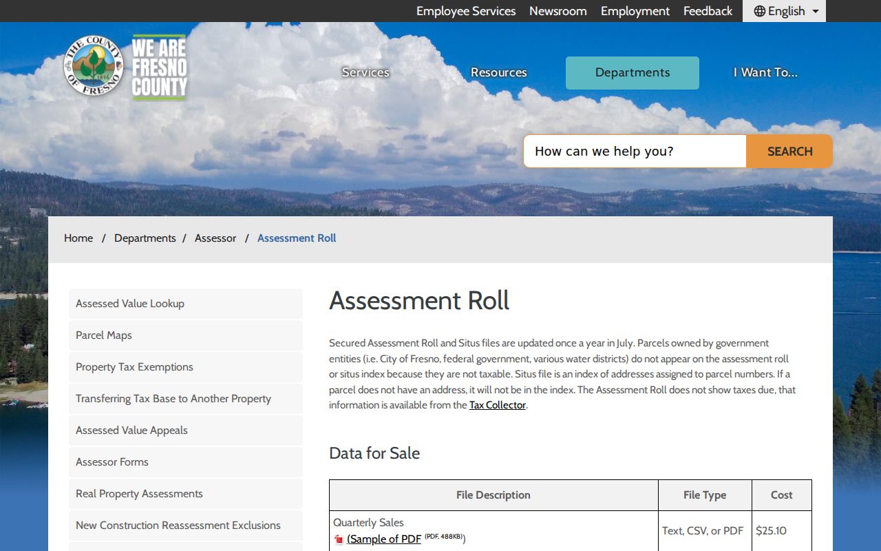
The Fresno County assessment-roll source also explains the paper and data-product paths that matter when a web search stops at the parcel map.
The field layout below keeps the map work and the ownership work distinct. A property address may be available only through an allowed or older route, so the same street can require more than one county channel.
| Field/tool | Type | Required | Use |
|---|---|---|---|
| APN | text | conditional | Exact parcel retrieval; use the format from the map or roll. |
| Property address | text | formerly/conditionally available | Address/APN matching was restricted online in 2025. |
| Map pan/zoom | map controls | no | Move along a street and inspect parcel boundaries. |
| Layer list | checkboxes | no | Parcels, jurisdiction/planning, and other published layers. |
| Identify/select | map tool | no | Click a parcel to expose available attributes. |
| Basemap | selector | no | Street or aerial context; not legal boundary evidence alone. |
After the public web change, the Assessor's data sales remain a documented route. Current Ownership Name and Mailing Address updates monthly at $30.94 in text or CSV and $54.94 in PDF. The Situs Index maps street address to APN and sorts by street at $29.21. Other listed products include the secured roll at $48.70, Additional Owners at $24, the unsecured roll at $29.68, and two-year quarterly sales at $25.10. Written orders go to Assessor Data Sales, P.O. Box 1146, Fresno, CA 93715, with file, format, contact, and delivery details. Payment is check or money order to Fresno County Treasurer, with media, FTP, or Dropbox delivery rather than email.
Note: An APN is a useful thread, but a long chain also needs the legal description and recorded instrument number.
GIS Parcel Layers Along Sanger Streets
The Fresno County GIS Mapping Applications make the street visual. Pan and zoom until parcel shapes are distinct, turn on published parcel and jurisdiction layers, then use Identify or Select. Record the APN, legal or map attributes that appear, and the city or county context before moving to the Assessor or Recorder. A basemap gives street or aerial context, but it is not legal boundary evidence by itself.
GIS is strongest for seeing how a whole street is divided. It does not promise an owner-name result for every parcel, and it does not replace a deed, a certified copy, or a current custodian record. For a long block, work parcel by parcel and keep the map key beside the search notes.
Note: The map shows relationships between parcels; the custodian's roll or instrument supplies the record that can be checked and cited.
Sanger's 2025 Address Match Change
Effective January 1, 2025, Fresno County's Assessor value page says public online functionality matching parcel numbers with addresses was removed in response to Government Code section 7928.205 protections for elected and appointed officials. That change matters to anyone who expects an unrestricted owner-by-address list. It is not a reason to guess. It is a reason to switch from the web screen to the parcel map, assessment-roll products, or the Assessor's public counter.
The annual roll is also a time-bound snapshot. It captures the January 1 owner and value, while a deed recorded later can show a midyear transfer. Keep the roll date beside the deed date, and separate the tax-mail address from the physical situs. Those small labels prevent a Sanger street directory from turning a dated ownership clue into a claim about current occupancy.
Recorder Deeds Behind a Sanger Street
The Fresno County Recorder's official copy workflow is built around recording numbers and grantor/grantee names, not a single property file. Search the owner's last name and first name, repeat the search for name variants and business names, and narrow by instrument type or date. The result can expose a document number, recording date, document type, grantor and grantee names, parcel number when indexed, and a link to index information.
The county's recorded-document instructions show the office route as well as the online route.
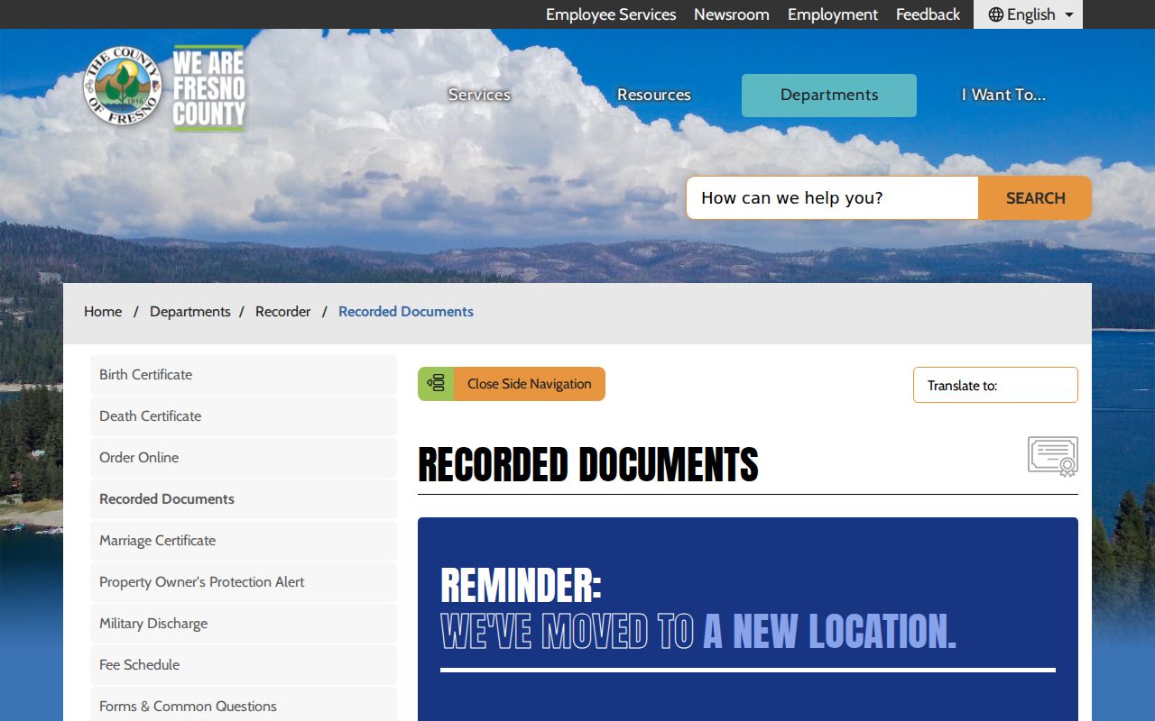
The Recorder is at 1250 Van Ness Avenue in Fresno. Land-record questions use 559-600-3471, and the office is open Monday through Friday from 8:30 to 4:30. Free inspection is available on second-floor computers through the Eagle Recording Kiosk and its Official Records Search and Copies option. Regular or certified copies may be purchased; a certified copy is mailed because it needs a live signature and seal.
For an instrument before 1981, a copy request needs the book, page, and year, along with a party name and document type. Online images must be downloaded before leaving the transaction. Credit or debit adds $2.50 under the cited county workflow, while check or money order is accepted. The Recorder's forms and search guidance is useful when a lien search or older reference needs a different starting key.
Note: A grantor transfers an interest and a grantee receives it, so each deed can point the search one step farther back.
Sanger Permits and iWorQ
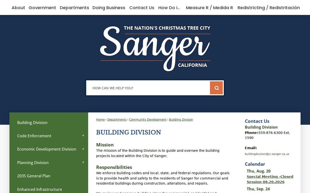
Permits add a work timeline to an address, not a resident list. Inside Sanger, the Sanger Building Division supplies permit applications, an extension form, an email route, and the iWorQ contractor portal. Permit evidence can include an applicant, owner, contractor, project address, APN, work description, valuation, issue or inspection status, and dates.
The Sanger Building Division page is the right local starting point for a project inside city limits.
That building record can distinguish a remodel, permit extension, or inspection event from a change in ownership. It still does not prove that an applicant or contractor lived at the project address.
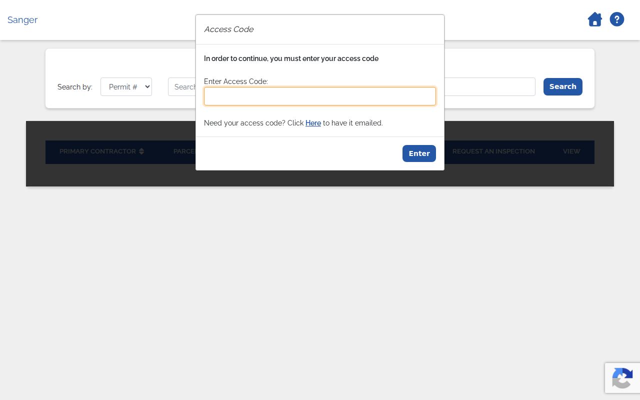
The public Sanger iWorQ permit search presents actions for Search for Building Permit, Apply for Building Permit, Search for Code Request, and Code Enforcement Request. Permit results can show Primary Contractor, Parcel Address, Permit Type, Applicant Address, Request an Inspection, and View.
Inspection requests use an access code and then ask for Requested By, phone, email, requested date and time, type, and comments. From January 1, 2026, the city directs inspection requests through that access-code portal. Requests received by 4 p.m. are processed for the following business day, with posted morning and afternoon windows that are not guaranteed. Code-request results can show a request number, request type, topic, violation description, location, status, and View. Do not infer that a complainant's identity is public because a location or status is visible.
The Sanger iWorQ permit search is the source for the permit and code-request view below.
The public-facing contractor portal did not document an unrestricted historical address search during inspection. Older permit jackets should be requested from the division. A Sanger street directory entry outside incorporated limits should instead be checked with Fresno County Public Works or Planning for the relevant permit path.
Sanger City and 93657 Boundaries
Postal city and municipal jurisdiction are different keys. ZIP Code 93657 covers incorporated Sanger plus substantial rural and eastern Fresno County territory toward Centerville and the Piedra foothill approaches. A mailing label can say Sanger while the parcel receives county, not city, permits and services. Check the exact address through USPS ZIP Lookup, then use the county GIS viewer and the City of Sanger records to confirm jurisdiction.
The Assessor does not assign street addresses. Inside Sanger, Building, Planning, and Public Works are the likely addressing contacts. In unincorporated 93657 territory, Fresno County planning, public works, and GIS control the relevant boundary questions. The distinction is practical: it tells a researcher which office should hold a permit, code case, or map record.
The Piedra library example shows why the distinction matters. Its physical location uses Sanger, California 93657, while its mailing identity uses P.O. Box 389, Piedra, California 93649. Read situs, mailing, postal, and jurisdiction fields separately before tying a block to a city record.
Sanborn Maps for Sanger Street History
Early street context comes from the Fresno County Public Library's Sanger Sanborn holdings. Editions or updates are documented for 1891, 1893, 1898, 1907, 1916, 1923, and through 1945. The earliest three are available digitally through the Library of Congress, and the local Heritage Center provides the library and microfilm path.
Sanborn sheets show building footprint, use, and older address labels. Compare a map with a directory year, a deed legal description, and later parcel shapes. An official Sanger street-renumbering ordinance and year were not verified, so a changed number should be supported by successive maps and directories rather than asserted as a citywide event.
- Parcel
- A mapped or assessed land unit identified by an APN. One person can hold more than one parcel.
- Situs address
- The physical location of the land or structure, distinct from the address used for tax mail.
- Legal description
- The land description carried by a deed, subdivision, lot, block, or map reference independent of postal numbering.
- Plat
- A recorded subdivision map that helps connect lots, blocks, boundaries, and legal descriptions.
- Criss-cross directory
- An address-keyed directory that works backward from a street or number to listed names, such as Haines from 1973.
These definitions keep a historic street trail legible. A parcel map is not a deed, a situs is not a mailing destination, and a criss-cross entry is not a complete household census.
Haines and Sanger Criss-Cross Records
The Fresno directory history collection places Haines countywide criss-cross coverage from 1973 beside Polk-Husted's 1907 to 1957 countywide run, later Sanger volumes, and rural telephone books. The Sanger Herald microfilm runs from September 1920 through December 2008, giving legal notices, sales, civic pages, and obituaries that can test a name found in a directory.
Use the criss-cross directory for a dated occupancy clue. It may omit rural households, non-subscribers, minors, and lodgers. Pair its name and number with the street's deed chain, Sanborn labels, and a current parcel record. The historical volumes themselves belong with the Sanger city directory collections, while a single person who needs identity verification belongs in the resident lookup path.
What a Sanger Street Directory Omits
A property result identifies a parcel interest, not every person who uses the address. Public layers do not supply a complete list of unlisted household members, children, roommates, utility customers, or delivery recipients. Driver address data is restricted under the federal Driver's Privacy Protection Act, and voter records have separate confidentiality rules. Even a matching tax mailing and situs address can support, but cannot prove, owner occupancy.
Lawful use. Sanger street and address records are appropriate for lawful personal research, family history, reconnecting, and civic curiosity. Do not use a record to stalk, harass, intimidate, or harm anyone, and do not try to fill a protected gap by inference.
When the goal changes from a whole street to one named person, the Sanger resident lookup route keeps identity checks separate from parcel and occupant clues.